United States
Kansas City Driving practice routes
Practise driving on the streets of Kansas City on a 3D map — free, in your browser, with nothing to install.
Open Kansas City in RoadariumThe simulator opens on the city map, where you choose any route.
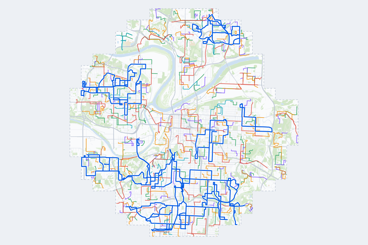
- 360Practice routes
- 634 miLength of all routes
- 27Different roundabouts
- 876Named streets
Route types
First drive
Quiet streets and simple junctions — a few easy turns
- Routes: 81
- Typical length: 1.0 mi
- Typical time: 3 min
Parking
A short drive that ends in a street with free kerbside bays
- Routes: 82
- Typical length: 0.8 mi
- Typical time: 3 min
Junctions
Give way, STOP and unmarked junctions on the side streets, with turns across the oncoming traffic — who goes first when there are no lights
- Routes: 81
- Typical length: 1.4 mi
- Typical time: 5 min
Roundabouts
One or more roundabouts on the way
- Routes: 25
- Typical length: 2.0 mi
- Typical time: 6 min
Rush hour
Busy avenues through the centre: traffic lights, lanes, turns across traffic
- Routes: 61
- Typical length: 2.0 mi
- Typical time: 6 min
Driving test practice
A drive like the practical test: from a test centre and back where one is known, over the roads and junctions the examiner covers.
- Routes: 30
- Typical length: 6.2 mi
- Typical time: 20 min
Test practice loops
The test drive here lasts about 20 min.
| Loop | Length | Time | Roundabouts | Traffic lights | Turns | Main streets |
|---|---|---|---|---|---|---|
| 01 | 5.3 mi | 17 min | 0 | 12 | 12 | Parallel Parkway, North 10th Street, Manorcrest Drive, Cleveland Avenue |
| 02 | 5.3 mi | 17 min | 0 | 9 | 15 | The Paseo, Benton Boulevard, Vine Street, East 25th Street |
| 03 | 5.3 mi | 17 min | 0 | 10 | 13 | Main Street, McGee Street, Wyandotte Street, Broadway Boulevard |
| 04 | 5.4 mi | 17 min | 0 | 16 | 15 | Parallel Parkway, North 17th Street, North 13th Street, Georgia Avenue |
| 05 | 5.4 mi | 18 min | 0 | 7 | 13 | Swope Parkway, Cleveland Avenue, Indiana Avenue, Askew Avenue |
| 06 | 5.5 mi | 18 min | 0 | 11 | 8 | West 61st Terrace, East 59th Street, West 62nd Street, Brookside Boulevard |
| 07 | 5.5 mi | 18 min | 1 | 14 | 20 | North 5th Street, North 10th Street, Minnesota Avenue, North 11th Street |
| 08 | 5.6 mi | 18 min | 0 | 5 | 21 | Elmwood Avenue, Doctor Martin Luther King Junior Boulevard, Emanuel Cleaver II Boulevard South, Blue Banks Avenue |
| 09 | 5.8 mi | 19 min | 0 | 17 | 17 | Rockhill Road, Main Street, Brookside Boulevard, Cherry Street |
| 10 | 5.8 mi | 19 min | 0 | 2 | 17 | Metropolitan Avenue, Steele Road, South 22nd Street, South 42nd Street |
| 11 | 5.9 mi | 19 min | 0 | 9 | 10 | East 39th Street, East 35th Street, Troost Avenue, South Benton Avenue |
| 12 | 6.0 mi | 19 min | 1 | 5 | 17 | Northeast Parvin Road, Northeast Chouteau Parkway, Northeast Davidson Road, Northeast 44th Street |
| 13 | 6.0 mi | 19 min | 0 | 15 | 20 | Broadway Boulevard, Wyoming Street, Westport Road, Wyandotte Street |
| 14 | 6.1 mi | 19 min | 0 | 11 | 25 | Parallel Parkway, Victory Drive, Wood Avenue, Brickel Boulevard |
| 15 | 6.1 mi | 19 min | 1 | 3 | 22 | Northeast Parvin Road, Northeast 43rd Street, North Brighton Avenue, Northeast Prather Road |
| 16 | 6.2 mi | 20 min | 1 | 16 | 22 | West 59th Street, Rockhill Road, East 51st Street, West 56th Street |
| 17 | 6.3 mi | 20 min | 0 | 21 | 9 | Parallel Parkway, North 10th Street, North 11th Street, North 43rd Street |
| 18 | 6.4 mi | 20 min | 0 | 1 | 8 | Metropolitan Avenue, South 12th Terrace, South 14th Street, Haas Drive |
| 19 | 6.4 mi | 21 min | 1 | 3 | 22 | Northeast 46th Street, North Campbell Street, Northeast Parvin Road, North Virginia Avenue |
| 20 | 6.4 mi | 21 min | 0 | 8 | 10 | East 12th Street, North Hardesty Avenue, East Truman Road, Bennington Avenue |
| 21 | 6.4 mi | 21 min | 0 | 7 | 29 | Merriam Drive, West 39th Avenue, West 42nd Avenue, State Line Road |
| 22 | 6.5 mi | 21 min | 0 | 11 | 17 | Rainbow Boulevard, South 7th Street Trafficway, Springfield Street, West 42nd Avenue |
| 23 | 6.5 mi | 21 min | 0 | 6 | 25 | North Antioch Road, Northeast Parvin Road, Northeast Chouteau Trafficway, Northeast Dean Lane |
| 24 | 6.6 mi | 21 min | 0 | 15 | 11 | East 55th Street, East 51st Street, Rockhill Road, East 59th Street |
| 25 | 6.7 mi | 21 min | 0 | 11 | 14 | Prospect Avenue, Benton Boulevard, East 9th Street, East 23rd Street |
| 26 | 6.7 mi | 22 min | 1 | 17 | 21 | Parallel Parkway, Wood Avenue, North 18th Street, Minnesota Avenue |
| 27 | 6.8 mi | 22 min | 0 | 8 | 25 | West 50th Street, West 55th Street, State Park Road, West 53rd Street |
| 28 | 7.1 mi | 23 min | 0 | 11 | 14 | East 39th Street, Prospect Avenue, Emanuel Cleaver II Boulevard South, East 51st Street |
| 29 | 7.1 mi | 23 min | 0 | 13 | 14 | North 10th Street, North 7th Street Trafficway, Sunshine Road, North 18th Street |
| 30 | 7.1 mi | 23 min | 0 | 7 | 24 | Emanuel Cleaver II Boulevard West, Denver Avenue, Benton Boulevard, Brighton Avenue |
Streets on the routes
The streets the routes of Kansas City use most.
- Cleveland Avenue
- Benton Boulevard
- North 10th Street
- North Antioch Road
- Oakley Avenue
- Parallel Parkway
- North Oak Trafficway
- Northeast Parvin Road
- Prospect Avenue
- Southwest Boulevard
- East 39th Street
- Northeast Vivion Road
- State Line Road
- Summit Street
- Wyandotte Street
- Doctor Martin Luther King Junior Boulevard
- East 51st Street
- East Truman Road
- Jackson Avenue
- North 27th Street
- North 5th Street
- North Brighton Avenue
- Pennsylvania Avenue
- Cherry Street
How it works
Open Kansas City in Roadarium.
Pick a route on the city map, or plan your own.
Drive it in 3D with traffic, signs and lights, then see what to work on.