United States
St. Louis Driving practice routes
Practise driving on the streets of St. Louis on a 3D map — free, in your browser, with nothing to install.
Open St. Louis in RoadariumThe simulator opens on the city map, where you choose any route.
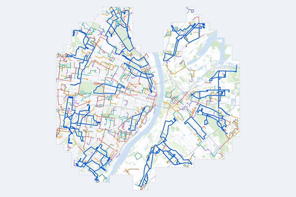
- 505Practice routes
- 876 miLength of all routes
- 57Different roundabouts
- 1,316Named streets
Route types
First drive
Quiet streets and simple junctions — a few easy turns
- Routes: 115
- Typical length: 1.1 mi
- Typical time: 4 min
Parking
A short drive that ends in a street with free kerbside bays
- Routes: 117
- Typical length: 0.8 mi
- Typical time: 3 min
Junctions
Give way, STOP and unmarked junctions on the side streets, with turns across the oncoming traffic — who goes first when there are no lights
- Routes: 113
- Typical length: 1.3 mi
- Typical time: 4 min
Roundabouts
One or more roundabouts on the way
- Routes: 49
- Typical length: 1.9 mi
- Typical time: 6 min
Rush hour
Busy avenues through the centre: traffic lights, lanes, turns across traffic
- Routes: 69
- Typical length: 2.0 mi
- Typical time: 6 min
Driving test practice
A drive like the practical test: from a test centre and back where one is known, over the roads and junctions the examiner covers.
- Routes: 42
- Typical length: 6.2 mi
- Typical time: 20 min
Test practice loops
The test drive here lasts about 20 min.
| Loop | Length | Time | Roundabouts | Traffic lights | Turns | Main streets |
|---|---|---|---|---|---|---|
| 01 | 5.3 mi | 17 min | 0 | 11 | 19 | Watson Road, Ivanhoe Avenue, Hampton Avenue, Southwest Avenue |
| 02 | 5.3 mi | 17 min | 0 | 2 | 14 | Washington Avenue, Edwardsville Road, Nameoki Road, East 20th Street |
| 03 | 5.3 mi | 17 min | 0 | 0 | 9 | South 19th Street, Mississippi Avenue, Falling Springs Road, Monsanto Avenue |
| 04 | 5.4 mi | 18 min | 2 | 6 | 19 | Loughborough Avenue, Holly Hills Boulevard, Vermont Avenue, Morganford Road |
| 05 | 5.5 mi | 18 min | 0 | 10 | 25 | Bayless Avenue, Kammerer Avenue, Weiss Avenue, Horn Avenue |
| 06 | 5.5 mi | 18 min | 0 | 1 | 10 | Broadway, State Street, Bissell Street, Cedar Street |
| 07 | 5.6 mi | 18 min | 0 | 5 | 12 | Saint Clair Avenue, Kingshighway, Vassar Avenue, North Kingshighway |
| 08 | 5.6 mi | 18 min | 0 | 1 | 9 | Missouri Avenue, South 26th Street, Jarvis Place, South 27th Street |
| 09 | 5.7 mi | 18 min | 0 | 3 | 16 | Lee Avenue, Penrose Street, Angelica Street, North Broadway |
| 10 | 5.7 mi | 18 min | 0 | 1 | 16 | State Street, Saint Clair Avenue, North 29th Street, Summit Avenue |
| 11 | 5.7 mi | 18 min | 0 | 1 | 12 | Adams Road, North Main Street, Water Street, St Rose Lane |
| 12 | 5.7 mi | 18 min | 1 | 18 | 21 | South Jefferson Avenue, South 12th Street, Gravois Avenue, South Tucker Boulevard |
| 13 | 5.8 mi | 19 min | 0 | 0 | 16 | Madison Avenue, 19th Street, West 20th Street, Delmar Avenue |
| 14 | 5.8 mi | 19 min | 0 | 0 | 17 | Caseyville Avenue, Forest Boulevard, Lynch Avenue, North 15th Street |
| 15 | 5.8 mi | 19 min | 0 | 12 | 21 | Union Road, Gravois Avenue, Weber Road, Hildesheim Avenue |
| 16 | 5.9 mi | 19 min | 0 | 13 | 11 | West Florissant Avenue, North Broadway, Baden Avenue, Drury Lane |
| 17 | 6.0 mi | 19 min | 2 | 13 | 20 | Saint Louis Avenue, Natural Bridge Avenue, Palm Street, Lexington Avenue |
| 18 | 6.0 mi | 19 min | 0 | 0 | 21 | Camp Jackson Road, Williams Street, Doris Avenue, St Paul Drive |
| 19 | 6.0 mi | 19 min | 2 | 23 | 25 | Natural Bridge Avenue, North 13th Street, North Florissant Avenue, Saint Louis Avenue |
| 20 | 6.1 mi | 20 min | 0 | 0 | 16 | Camp Jackson Road, Jerome Lane, Range Lane, Mousette Lane |
| 21 | 6.2 mi | 20 min | 0 | 9 | 19 | Union Road, Loughborough Avenue, Weber Road, Vermont Avenue |
| 22 | 6.2 mi | 20 min | 1 | 7 | 25 | Goodfellow Boulevard, West Florissant Avenue, Jennings Station Road, Riverview Boulevard |
| 23 | 6.3 mi | 20 min | 0 | 0 | 9 | Forest Boulevard, Caseyville Avenue, Waverly Avenue, North 25th Street |
| 24 | 6.3 mi | 20 min | 1 | 9 | 26 | Natural Bridge Road, Lucas-Hunt Road, Maywood Avenue, Bellerive Drive |
| 25 | 6.3 mi | 20 min | 1 | 16 | 24 | North Broadway, Halls Ferry Road, Church Road, Lewis and Clark Boulevard |
| 26 | 6.4 mi | 21 min | 0 | 0 | 18 | Washington Avenue, Madison Avenue, Dogwood Drive, Niedringhaus Avenue |
| 27 | 6.4 mi | 21 min | 0 | 0 | 18 | State Street, Lake Drive, Park Drive, Ridge Avenue |
| 28 | 6.5 mi | 21 min | 0 | 0 | 19 | Camp Jackson Road, Water Street, Paris Avenue, Range Lane |
| 29 | 6.5 mi | 21 min | 0 | 0 | 15 | Camp Jackson Road, Doris Avenue, Falling Springs Road, Jerome Lane |
| 30 | 6.5 mi | 21 min | 1 | 20 | 15 | Clayton Avenue, Lindell Boulevard, South Sarah Street, Washington Boulevard |
| 31 | 6.6 mi | 21 min | 0 | 2 | 15 | Collinsville Road, Maryland Avenue, Sand Prairie Road, North 63rd Street |
| 32 | 6.7 mi | 22 min | 0 | 10 | 22 | Pernod Avenue, Arsenal Street, Sublette Avenue, Tholozan Avenue |
| 33 | 6.7 mi | 22 min | 0 | 10 | 13 | West Florissant Avenue, Goodfellow Boulevard, Shreve Avenue, Lee Avenue |
| 34 | 6.8 mi | 22 min | 0 | 14 | 26 | Lansdowne Avenue, Jamieson Avenue, Shrewsbury Avenue, Wellington Avenue |
| 35 | 6.9 mi | 22 min | 0 | 0 | 15 | Lake Drive, State Street, North Kingshighway, Vogel Place |
| 36 | 7.0 mi | 23 min | 0 | 8 | 20 | Page Boulevard, Kienlen Avenue, Myron Avenue, Ferguson Avenue |
| 37 | 7.0 mi | 23 min | 0 | 11 | 24 | Weber Road, Union Road, Bayless Avenue, Lemay Ferry Road |
| 38 | 7.0 mi | 23 min | 0 | 1 | 14 | Kingshighway, Collinsville Road, North 63rd Street, Maryland Avenue |
| 39 | 7.1 mi | 23 min | 0 | 19 | 17 | South Big Bend Boulevard, Wabash Avenue, Bellevue Avenue, Shrewsbury Avenue |
| 40 | 7.1 mi | 23 min | 0 | 0 | 19 | Mississippi Avenue, Water Street, North 5th Street, North Main Street |
| 41 | 7.1 mi | 23 min | 0 | 18 | 15 | South Skinker Boulevard, Westgate Avenue, Wydown Boulevard, Ogden Avenue |
| 42 | 7.1 mi | 23 min | 0 | 17 | 34 | Mackenzie Road, River Des Peres Boulevard, Wellington Avenue, Shrewsbury Avenue |
Streets on the routes
The streets the routes of St. Louis use most.
- State Street
- Jennings Station Road
- Saint Louis Avenue
- North Broadway
- Goodfellow Boulevard
- Halls Ferry Road
- South Broadway
- Chippewa Street
- North Kingshighway Boulevard
- Camp Jackson Road
- Jerome Lane
- North 25th Street
- North 2nd Street
- Pennsylvania Avenue
- West Florissant Avenue
- Arsenal Street
- Gravois Avenue
- Hampton Avenue
- Loughborough Avenue
- Maryland Avenue
- Missouri Avenue
- Natural Bridge Road
- Ridge Avenue
- Riverview Boulevard
How it works
Open St. Louis in Roadarium.
Pick a route on the city map, or plan your own.
Drive it in 3D with traffic, signs and lights, then see what to work on.