
United States
Memphis: driving practice routes
Practise driving on the streets of Memphis on a 3D map — free, in your browser, with nothing to install.
Open Memphis in RoadariumThe simulator opens on the city map, where you choose any route.
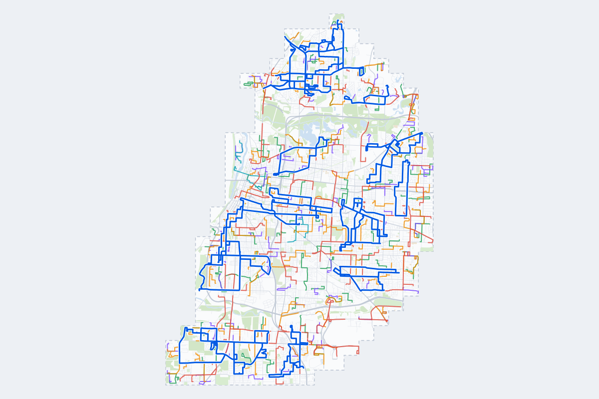
- 346Practice routes
- 617 miLength of all routes
- 7Different roundabouts
- 1,067Named streets
Route types
| Type | Routes | Typical length | Typical time |
|---|---|---|---|
First driveQuiet streets and simple junctions — a few easy turns | 80 | 1.0 mi | 3 min |
ParkingA short drive that ends in a street with free kerbside bays | 82 | 0.8 mi | 3 min |
JunctionsGive way, STOP and unmarked junctions on the side streets, with turns across the oncoming traffic — who goes first when there are no lights | 82 | 1.4 mi | 5 min |
RoundaboutsOne or more roundabouts on the way | 6 | 2.2 mi | 7 min |
Rush hourBusy avenues through the centre: traffic lights, lanes, turns across traffic | 66 | 2.1 mi | 7 min |
Driving test practiceA drive like the practical test: from a test centre and back where one is known, over the roads and junctions the examiner covers. | 30 | 6.3 mi | 20 min |
Test practice loops
The test drive here lasts about 20 min.
| Loop | Length | Time | Roundabouts | Traffic lights | Turns | Main streets |
|---|---|---|---|---|---|---|
| 1 | 5.3 mi | 17 min | 0 | 2 | 24 | Millbranch Road, Graceland Drive, Josibpet Lane, East Brooks Road |
| 2 | 5.3 mi | 17 min | 0 | 15 | 13 | Madison Avenue, Peabody Avenue, South Rembert Street, South Pauline Street |
| 3 | 5.4 mi | 17 min | 0 | 5 | 17 | Whitney Avenue, Dellwood Avenue, Driftwood Avenue, North Watkins Street |
| 4 | 5.4 mi | 17 min | 0 | 2 | 13 | Wellons Avenue, Saint Elmo Avenue, North Watkins Street, Macaulay Avenue |
| 5 | 5.5 mi | 18 min | 0 | 4 | 15 | Kimball Avenue, Lamar Avenue, Lowell Avenue, South Highland Street |
| 6 | 5.6 mi | 18 min | 0 | 12 | 15 | Poplar Avenue, Walnut Grove Road, South Highland Street, South Reese Street |
| 7 | 5.7 mi | 18 min | 0 | 5 | 10 | Rhodes Avenue, Kimball Avenue, Barron Avenue, Hugenot Street |
| 8 | 5.7 mi | 18 min | 0 | 3 | 21 | James Road, Scenic Highway, Windermere Road, Mahue Drive |
| 9 | 5.8 mi | 19 min | 0 | 3 | 14 | West Fairway Avenue, East Mitchell Road, West Brooks Road, West Mitchell Road |
| 10 | 5.8 mi | 19 min | 0 | 2 | 14 | North Graham Street, High Point Terrace, Maria Street, Walnut Grove Road |
| 11 | 5.9 mi | 19 min | 0 | 6 | 18 | Frayser Boulevard, New Frayser Raleigh Road, Corning Avenue, Cassie Avenue |
| 12 | 6.0 mi | 19 min | 0 | 6 | 11 | Whitney Avenue, University Street, Clifton Avenue, Canfield Avenue |
| 13 | 6.0 mi | 19 min | 0 | 6 | 13 | South Parkway West, West Person Avenue, East McLemore Avenue, Latham Street |
| 14 | 6.1 mi | 20 min | 0 | 5 | 18 | East Raines Road, Winchester Road, Millbranch Road, Marlin Road |
| 15 | 6.2 mi | 20 min | 0 | 7 | 14 | South Parkway East, Latham Street, Mississippi Boulevard, East Person Avenue |
| 16 | 6.3 mi | 20 min | 0 | 4 | 15 | Neely Road, East Levi Road, Winchester Road, East Brooks Road |
| 17 | 6.3 mi | 20 min | 0 | 7 | 5 | West Mallory Avenue, Latham Street, West Person Avenue, South Parkway East |
| 18 | 6.4 mi | 21 min | 0 | 4 | 26 | National Street, Macon Road, Homer Street, North Holmes Street |
| 19 | 6.4 mi | 21 min | 0 | 0 | 19 | Saint Elmo Avenue, Wellons Avenue, Range Line Road, Mountain Terrace Street |
| 20 | 6.5 mi | 21 min | 0 | 10 | 18 | Southern Avenue, Poplar Avenue, South Alicia Drive, Central Avenue |
| 21 | 6.5 mi | 21 min | 0 | 24 | 13 | Peabody Avenue, Central Avenue, Union Avenue, Dr. Martin Luther King Jr Avenue |
| 22 | 6.6 mi | 21 min | 0 | 13 | 22 | Florida Street, Pennsylvania Street, Kansas Street, Ida B. Wells Street |
| 23 | 6.6 mi | 21 min | 0 | 5 | 29 | East Chickasaw Parkway, South Fenwick Road, Josephine Street, Tillman Street |
| 24 | 6.6 mi | 21 min | 0 | 3 | 14 | West Levi Road, Weaver Road, King Road, South Third Street |
| 25 | 6.7 mi | 21 min | 0 | 3 | 21 | Chelsea Avenue, Townes Avenue, Mount Olive Road, Walter Street |
| 26 | 6.7 mi | 21 min | 0 | 7 | 21 | North Watkins Street, Felts Station Road, Whitney Avenue, Cornell Street |
| 27 | 6.8 mi | 22 min | 0 | 19 | 16 | Madison Avenue, Poplar Avenue, Union Avenue, Jefferson Avenue |
| 28 | 7.0 mi | 22 min | 0 | 2 | 18 | Frayser Raleigh Road, Range Line Road, Point Church Avenue, Frayser Boulevard |
| 29 | 7.1 mi | 23 min | 0 | 5 | 21 | Winchester Road, East Levi Road, West Fairway Avenue, Dolan Road |
| 30 | 7.1 mi | 23 min | 0 | 12 | 16 | Chelsea Avenue, Jackson Avenue, Breedlove Street, North McLean Boulevard |
Streets on the routes
The streets the routes of Memphis use most.
- Chelsea Avenue
- Poplar Avenue
- North Watkins Street
- Winchester Road
- Frayser Boulevard
- East Brooks Road
- James Road
- Kansas Street
- Lamar Avenue
- Whitney Avenue
- Overton Crossing Street
- Range Line Road
- Thomas Street
- Central Avenue
- Madison Avenue
- Mountain Terrace Street
- South Parkway East
- South Third Street
- Southern Avenue
- Warford Street
- Airways Boulevard
- Corning Avenue
- Florida Street
- Jackson Avenue
Nearby
How it works
- Open Memphis in Roadarium.
- Pick a route on the city map, or plan your own.
- Drive it in 3D with traffic, signs and lights, then see what to work on.