
United States
Minneapolis: driving practice routes
Practise driving on the streets of Minneapolis on a 3D map — free, in your browser, with nothing to install.
Open Minneapolis in RoadariumThe simulator opens on the city map, where you choose any route.
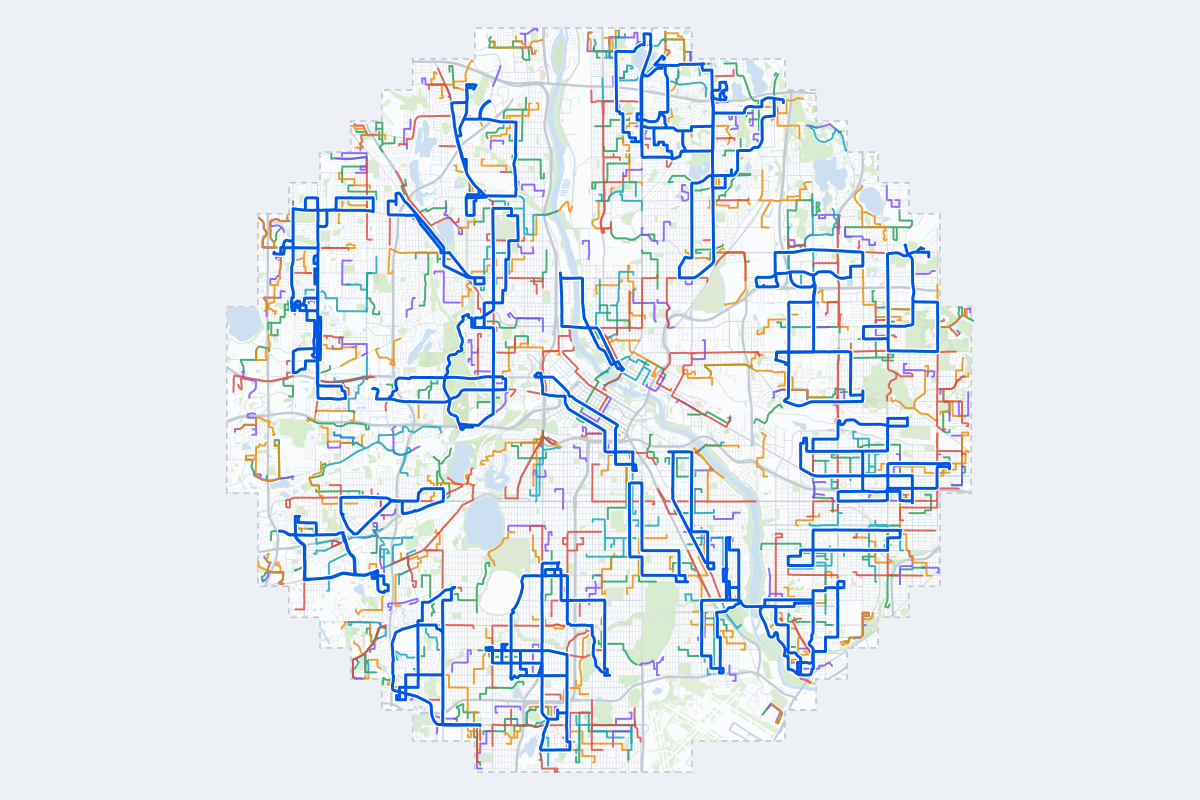
- 568Practice routes
- 1,004 miLength of all routes
- 77Different roundabouts
- 1,409Named streets
Route types
| Type | Routes | Typical length | Typical time |
|---|---|---|---|
First driveQuiet streets and simple junctions — a few easy turns | 124 | 1.1 mi | 4 min |
ParkingA short drive that ends in a street with free kerbside bays | 126 | 0.8 mi | 3 min |
JunctionsGive way, STOP and unmarked junctions on the side streets, with turns across the oncoming traffic — who goes first when there are no lights | 125 | 1.4 mi | 5 min |
RoundaboutsOne or more roundabouts on the way | 59 | 2.1 mi | 7 min |
Rush hourBusy avenues through the centre: traffic lights, lanes, turns across traffic | 92 | 2.1 mi | 7 min |
Driving test practiceA drive like the practical test: from a test centre and back where one is known, over the roads and junctions the examiner covers. | 42 | 6.3 mi | 20 min |
Test practice loops
The test drive here lasts about 20 min.
| Loop | Length | Time | Roundabouts | Traffic lights | Turns | Main streets |
|---|---|---|---|---|---|---|
| 1 | 5.4 mi | 17 min | 0 | 8 | 14 | Minnehaha Avenue, Energy Park Drive, Lexington Parkway North, Hewitt Avenue |
| 2 | 5.7 mi | 18 min | 0 | 2 | 17 | Highway 65 Northeast, 7th Street Northeast, 61st Avenue Northeast, Central Avenue Northeast |
| 3 | 5.7 mi | 18 min | 0 | 20 | 10 | Northeast Main Street, Northeast 2nd Street, West Broadway Avenue, Northeast Lowry Avenue |
| 4 | 5.7 mi | 18 min | 0 | 8 | 19 | Edgcumbe Road, Snelling Avenue South, Fairview Avenue South, Norfolk Avenue |
| 5 | 5.8 mi | 19 min | 2 | 14 | 13 | Excelsior Boulevard, Blake Road North, Louisiana Avenue South, Walker Street |
| 6 | 5.8 mi | 19 min | 0 | 5 | 14 | Winnetka Avenue North, Boone Avenue North, 45th Avenue North, Medicine Lake Road |
| 7 | 5.8 mi | 19 min | 0 | 6 | 8 | Larpenteur Avenue West, Como Avenue, North Cleveland Avenue, Pascal Street North |
| 8 | 5.8 mi | 19 min | 0 | 12 | 14 | Minnetonka Boulevard, Lake Street West, Gorham Avenue, Highway 7 |
| 9 | 5.9 mi | 19 min | 0 | 12 | 14 | County Road C, Terminal Road, County Road B2, Long Lake Road |
| 10 | 5.9 mi | 19 min | 0 | 9 | 19 | Winnetka Avenue North, Faribault Street, Plymouth Avenue North, Utah Avenue North |
| 11 | 6.0 mi | 19 min | 0 | 7 | 14 | Silver Lake Road Northwest, 49th Avenue Northeast, Matterhorn Drive Northeast, Buchanan Place Northeast |
| 12 | 6.0 mi | 19 min | 0 | 10 | 10 | Saint Clair Avenue, Fairview Avenue South, West Juliet Avenue, Lexington Parkway South |
| 13 | 6.0 mi | 19 min | 0 | 11 | 20 | Winnetka Avenue North, Valders Avenue North, Western Avenue, 23rd Avenue North |
| 14 | 6.0 mi | 19 min | 1 | 15 | 10 | 26th Avenue South, 31st Avenue South, 36th Avenue South, East Franklin Avenue |
| 15 | 6.1 mi | 20 min | 0 | 11 | 13 | Northeast Lowry Avenue, Stinson Boulevard Northeast, Silver Lane Northeast, 39th Avenue Northeast |
| 16 | 6.1 mi | 20 min | 0 | 18 | 11 | Thomas Avenue, Saint Anthony Avenue, Concordia Avenue, Marshall Avenue |
| 17 | 6.1 mi | 20 min | 0 | 14 | 12 | Fairview Avenue North, North Cleveland Avenue, Larpenteur Avenue West, State Highway 36 Service Road |
| 18 | 6.2 mi | 20 min | 1 | 12 | 16 | Lyndale Avenue South, West 56th Street, West 58th Street, Nicollet Avenue |
| 19 | 6.3 mi | 20 min | 0 | 15 | 16 | Silver Lake Road, Silver Lane Northeast, Old Highway 8 Northwest, 10th Street Northwest |
| 20 | 6.3 mi | 20 min | 0 | 19 | 12 | Cedar Avenue South, Bloomington Avenue, East 42nd Street, East 38th Street |
| 21 | 6.3 mi | 20 min | 0 | 5 | 8 | Lexington Avenue North, Victoria Street North, Larpenteur Avenue West, Dale Street North |
| 22 | 6.3 mi | 20 min | 2 | 3 | 24 | Central Avenue Northeast, Matterhorn Drive Northeast, 44th Avenue Northeast, Chatham Road Northeast |
| 23 | 6.4 mi | 20 min | 0 | 5 | 22 | West Broadway Avenue, Oakdale Avenue North, Hubbard Avenue North, 42nd Avenue North |
| 24 | 6.4 mi | 21 min | 0 | 9 | 20 | 42nd Avenue North, 45th Avenue North, 36th Avenue North, Boone Avenue North |
| 25 | 6.4 mi | 21 min | 0 | 11 | 19 | Lyndale Avenue South, East Lake Harriet Parkway, James Avenue South, West 58th Street |
| 26 | 6.4 mi | 21 min | 0 | 3 | 11 | Victoria Street North, Lexington Avenue North, County Road C, Garden Avenue West |
| 27 | 6.4 mi | 21 min | 0 | 11 | 12 | 42nd Avenue South, East 46th Street, 46th Avenue South, Highland Parkway |
| 28 | 6.5 mi | 21 min | 0 | 14 | 10 | Glenwood Avenue, Olson Memorial Highway, Olson Memorial Highway Frontage Road South, Meander Road |
| 29 | 6.6 mi | 21 min | 0 | 8 | 18 | North Penn Avenue, North Logan Avenue, North Humboldt Avenue, North Sheridan Avenue |
| 30 | 6.6 mi | 21 min | 0 | 7 | 22 | Silver Lake Road Northwest, Fairway Drive Northeast, Silver Lake Road, 45th Avenue Northeast |
| 31 | 6.7 mi | 22 min | 2 | 19 | 18 | Excelsior Boulevard, Walker Street, Louisiana Avenue South, Brookside Avenue South |
| 32 | 6.7 mi | 22 min | 0 | 17 | 14 | Chicago Avenue, Nicollet Avenue, West 46th Street, Portland Avenue |
| 33 | 6.7 mi | 22 min | 0 | 13 | 16 | Theodore Wirth Parkway, North Penn Avenue, Cedar Lake Road South, Golden Valley Road |
| 34 | 6.8 mi | 22 min | 0 | 10 | 15 | North Humboldt Avenue, Brooklyn Boulevard, Victory Memorial Drive, Shingle Creek Parkway |
| 35 | 6.8 mi | 22 min | 1 | 14 | 19 | Ford Parkway, 34th Avenue South, East 46th Street, 40th Avenue South |
| 36 | 6.8 mi | 22 min | 0 | 7 | 22 | France Avenue South, Wooddale Avenue, West 58th Street, Sunnyside Road |
| 37 | 7.0 mi | 22 min | 0 | 21 | 15 | University Avenue West, Minnehaha Avenue, Hamline Avenue North, Concordia Avenue |
| 38 | 7.0 mi | 23 min | 2 | 51 | 18 | South 7th Street, 10th Street North, 11th Avenue South, East Franklin Avenue |
| 39 | 7.0 mi | 23 min | 1 | 19 | 14 | France Avenue South, West 66th Street, West 50th Street, Halifax Avenue South |
| 40 | 7.0 mi | 23 min | 0 | 5 | 19 | South Mississippi River Boulevard, Ford Parkway, Cleveland Avenue, East 46th Street |
| 41 | 7.1 mi | 23 min | 0 | 8 | 22 | Brooklyn Boulevard, Xerxes Avenue North, Victory Memorial Drive, Osseo Road |
| 42 | 7.1 mi | 23 min | 6 | 13 | 15 | Lyndale Avenue South, Nicollet Avenue, West 54th Street, West 56th Street |
Streets on the routes
The streets the routes of Minneapolis use most.
- Central Avenue Northeast
- Excelsior Boulevard
- Winnetka Avenue North
- 36th Avenue North
- Douglas Drive North
- Fairview Avenue North
- France Avenue South
- Minnehaha Avenue
- West 66th Street
- Lyndale Avenue South
- Olson Memorial Highway
- Boone Avenue North
- Dale Street North
- Glenwood Avenue
- 42nd Avenue North
- Hamline Avenue North
- Louisiana Avenue South
- Snelling Avenue
- Wooddale Avenue
- 5th Street Northeast
- 61st Avenue Northeast
- Cedar Lake Road
- Edgcumbe Road
- Golden Valley Road
Nearby
How it works
- Open Minneapolis in Roadarium.
- Pick a route on the city map, or plan your own.
- Drive it in 3D with traffic, signs and lights, then see what to work on.