United States
Virginia Beach Driving practice routes
Practise driving on the streets of Virginia Beach on a 3D map — free, in your browser, with nothing to install.
Open Virginia Beach in RoadariumThe simulator opens on the city map, where you choose any route.
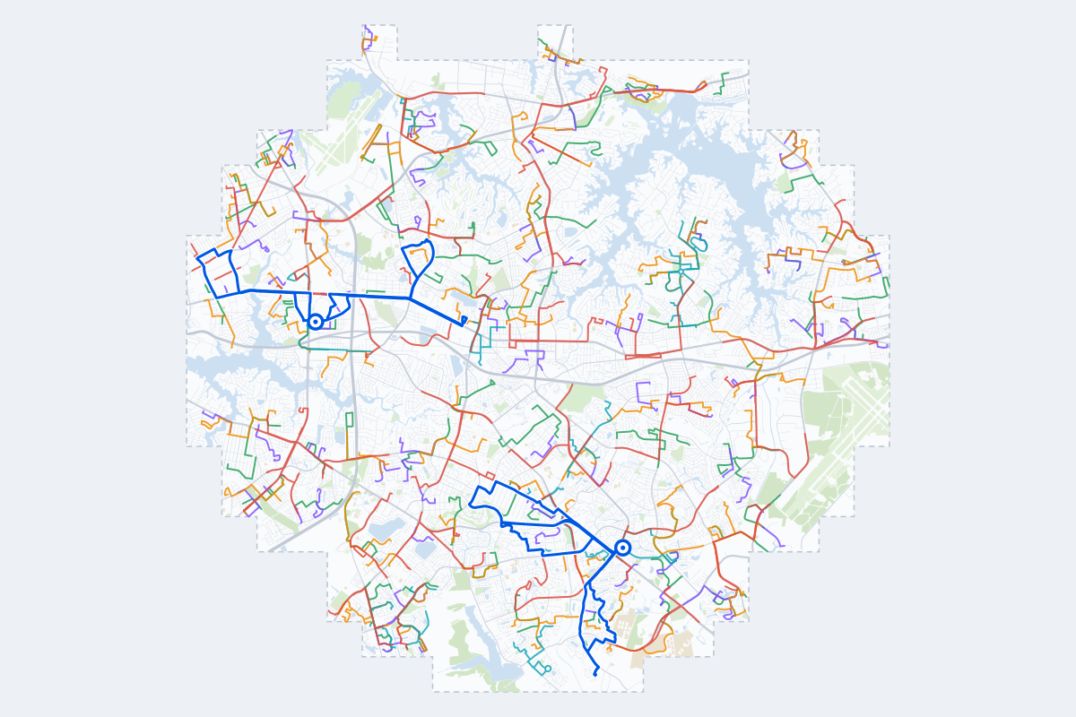
- 318Practice routes
- 476 miLength of all routes
- 21Different roundabouts
- 908Named streets
Route types
First drive
Quiet streets and simple junctions — a few easy turns
- Routes: 76
- Typical length: 1.1 mi
- Typical time: 4 min
Parking
A short drive that ends in a street with free kerbside bays
- Routes: 78
- Typical length: 0.8 mi
- Typical time: 3 min
Junctions
Give way, STOP and unmarked junctions on the side streets, with turns across the oncoming traffic — who goes first when there are no lights
- Routes: 77
- Typical length: 1.3 mi
- Typical time: 4 min
Roundabouts
One or more roundabouts on the way
- Routes: 22
- Typical length: 2.3 mi
- Typical time: 7 min
Rush hour
Busy avenues through the centre: traffic lights, lanes, turns across traffic
- Routes: 59
- Typical length: 2.2 mi
- Typical time: 7 min
Driving test practice
A drive like the practical test: from a test centre and back where one is known, over the roads and junctions the examiner covers.
- Routes: 6
- Typical length: 6.7 mi
- Typical time: 22 min
Test practice loops
The test drive here lasts about 20 min. Each loop starts and finishes at the test centre.
| Loop | Test centre | Length | Time | Roundabouts | Traffic lights | Turns | Main streets |
|---|---|---|---|---|---|---|---|
| 01 | Norfolk/Military Circle | 6.4 mi | 21 min | 1 | 19 | 14 | East Virginia Beach Boulevard, Ingleside Road, Azalea Garden Road, Briar Hill Road |
| 02 | Norfolk/Military Circle | 6.7 mi | 22 min | 0 | 14 | 21 | Virginia Beach Boulevard, East Virginia Beach Boulevard, Poplar Hall Drive, Glenrock Road |
| 03 | Norfolk/Military Circle | 7.0 mi | 22 min | 0 | 14 | 23 | East Virginia Beach Boulevard, Newtown Road, Diamond Springs Road, Baker Road |
| 04 | Virginia Beach/Buckner | 5.7 mi | 18 min | 0 | 12 | 17 | Ferrell Parkway, Lynnhaven Parkway, Princess Anne Road, South Independence Boulevard |
| 05 | Virginia Beach/Buckner | 6.7 mi | 21 min | 0 | 6 | 27 | Salem Road, South Independence Boulevard, Centennial Circle, Highland Cape Lane |
| 06 | Virginia Beach/Buckner | 7.1 mi | 23 min | 0 | 12 | 17 | Ferrell Parkway, Princess Anne Road, Providence Road, Pleasant Valley Road |
Streets on the routes
The streets the routes of Virginia Beach use most.
- Lynnhaven Parkway
- Princess Anne Road
- Shore Drive
- South Independence Boulevard
- Indian River Road
- Kempsville Road
- Providence Road
- Baker Road
- Centerville Turnpike
- Virginia Beach Boulevard
- Azalea Garden Road
- Diamond Springs Road
- East Virginia Beach Boulevard
- Salem Road
- Holland Road
- North Great Neck Road
- North Military Highway
- South Military Highway
- Bayside Road
- North Witchduck Road
- Poplar Hall Drive
- Edinburgh Drive
- First Colonial Road
- Kings Grant Road
How it works
Open Virginia Beach in Roadarium.
Pick a route on the city map, or plan your own.
Drive it in 3D with traffic, signs and lights, then see what to work on.