
United States
Pittsburgh: driving practice routes
Practise driving on the streets of Pittsburgh on a 3D map — free, in your browser, with nothing to install.
Open Pittsburgh in RoadariumThe simulator opens on the city map, where you choose any route.
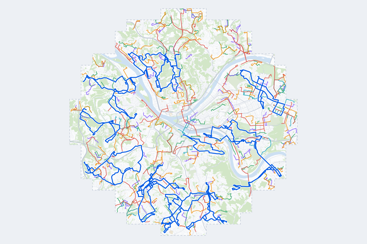
- 352Practice routes
- 625 miLength of all routes
- 12Different roundabouts
- 1,436Named streets
Route types
| Type | Routes | Typical length | Typical time |
|---|---|---|---|
First driveQuiet streets and simple junctions — a few easy turns | 81 | 1.0 mi | 3 min |
ParkingA short drive that ends in a street with free kerbside bays | 83 | 0.8 mi | 3 min |
JunctionsGive way, STOP and unmarked junctions on the side streets, with turns across the oncoming traffic — who goes first when there are no lights | 82 | 1.4 mi | 4 min |
RoundaboutsOne or more roundabouts on the way | 16 | 2.3 mi | 7 min |
Rush hourBusy avenues through the centre: traffic lights, lanes, turns across traffic | 61 | 2.2 mi | 7 min |
Driving test practiceA drive like the practical test: from a test centre and back where one is known, over the roads and junctions the examiner covers. | 29 | 6.5 mi | 21 min |
Test practice loops
The test drive here lasts about 20 min.
| Loop | Length | Time | Roundabouts | Traffic lights | Turns | Main streets |
|---|---|---|---|---|---|---|
| 1 | 5.4 mi | 17 min | 0 | 3 | 23 | Perrysville Avenue, Marshall Avenue, Woods Run Avenue, Mairdale Avenue |
| 2 | 5.5 mi | 18 min | 0 | 20 | 18 | West Street, Beechwood Boulevard, Maple Street, Murray Avenue |
| 3 | 5.5 mi | 18 min | 0 | 5 | 21 | Perrysville Avenue, Marshall Avenue, Woods Run Avenue, Stayton Street |
| 4 | 5.6 mi | 18 min | 0 | 12 | 22 | Broadway Avenue, West Liberty Avenue, Dell Avenue, Bower Hill Road |
| 5 | 5.7 mi | 18 min | 0 | 5 | 25 | Library Road, McRoberts Road, Hamilton Road, Lucille Drive |
| 6 | 5.8 mi | 19 min | 0 | 8 | 17 | Baptist Road, Brownsville Road, Prospect Road, East Willock Road |
| 7 | 5.8 mi | 19 min | 0 | 12 | 30 | Evergreen Road, Perrysville Avenue, Venture Street, Milroy Street |
| 8 | 5.9 mi | 19 min | 0 | 7 | 19 | Library Road, McNeilly Road, Middleboro Road, Pearce Road |
| 9 | 5.9 mi | 19 min | 0 | 1 | 21 | Steuben Street, Wind Gap Bridge, Woodlow Street, Berry Street |
| 10 | 6.0 mi | 19 min | 0 | 4 | 14 | Steubenville Pike, Country Club Drive, Baldwin Road, Ingram Avenue |
| 11 | 6.1 mi | 19 min | 0 | 6 | 20 | Arlington Avenue, Spring Street, P J McArdle Roadway, Pius Street |
| 12 | 6.1 mi | 20 min | 0 | 10 | 14 | Bascom Avenue, Brighton Road, Woods Run Avenue, California Avenue |
| 13 | 6.3 mi | 20 min | 0 | 22 | 19 | Washington Road, Scott Road, Mount Lebanon Boulevard, Annex Avenue |
| 14 | 6.4 mi | 21 min | 0 | 9 | 21 | Hope Hollow Road, Swallow Hill Road, Delfred Drive, Chestnut Street |
| 15 | 6.5 mi | 21 min | 0 | 12 | 21 | Greenfield Avenue, Hobart Street, Schenley Drive, Swinburne Street |
| 16 | 6.6 mi | 21 min | 0 | 10 | 24 | California Avenue, Ohio River Boulevard, McKees Rocks Bridge, Helen Street |
| 17 | 6.7 mi | 22 min | 0 | 17 | 15 | Greentree Road, Mansfield Avenue, Forsythe Road, Chestnut Street |
| 18 | 6.7 mi | 22 min | 0 | 14 | 19 | Brighton Heights Boulevard, Saint John Street, Island Avenue, California Avenue |
| 19 | 6.7 mi | 22 min | 1 | 18 | 20 | Hamilton Avenue, North Dallas Avenue, Meadow Street, East Liberty Boulevard |
| 20 | 6.8 mi | 22 min | 0 | 26 | 24 | McCandless Avenue, North Highland Avenue, Shady Avenue, Schenley Manor Drive |
| 21 | 6.8 mi | 22 min | 0 | 23 | 29 | Washington Road, Brookline Boulevard, Dell Avenue, Pioneer Avenue |
| 22 | 6.8 mi | 22 min | 0 | 13 | 22 | Pine Hollow Road, Chartiers Avenue Extended, Chartiers Avenue, Island Avenue |
| 23 | 6.9 mi | 22 min | 0 | 15 | 22 | Greentree Road, Hope Hollow Road, Forsythe Road, West Main Street |
| 24 | 6.9 mi | 22 min | 0 | 7 | 14 | Steubenville Pike, West Steuben Street, South Linwood Avenue, Crafton Boulevard |
| 25 | 7.0 mi | 23 min | 0 | 5 | 35 | Prospect Road, Brownsville Road, Kirk Avenue, Clermont Avenue |
| 26 | 7.1 mi | 23 min | 0 | 23 | 34 | Greenfield Avenue, East Carson Street, Swinburne Street, Forbes Avenue |
| 27 | 7.1 mi | 23 min | 0 | 26 | 23 | Washington Road, Scott Road, Hoodridge Drive, Potomac Avenue |
| 28 | 7.1 mi | 23 min | 0 | 9 | 32 | Maytide Street, Killarney Drive, Stewart Avenue, Brentwood Avenue |
| 29 | 7.1 mi | 23 min | 0 | 7 | 24 | 8th Avenue, Glass Run Road, West 7th Avenue, Cathell Road |
Streets on the routes
The streets the routes of Pittsburgh use most.
- Penn Avenue
- Lincoln Avenue
- Sarah Street
- Brownsville Road
- Butler Street
- Grant Avenue
- Perrysville Avenue
- Washington Road
- California Avenue
- Chartiers Avenue
- Brighton Road
- Cedar Boulevard
- Crafton Boulevard
- Fifth Avenue
- Noblestown Road
- Shady Avenue
- Broadway Avenue
- Center Avenue
- Chestnut Street
- Greenfield Avenue
- Greenhurst Drive
- Locust Street
- Montezuma Street
- Potomac Avenue
Nearby
How it works
- Open Pittsburgh in Roadarium.
- Pick a route on the city map, or plan your own.
- Drive it in 3D with traffic, signs and lights, then see what to work on.