
United States
Cincinnati: driving practice routes
Practise driving on the streets of Cincinnati on a 3D map — free, in your browser, with nothing to install.
Open Cincinnati in RoadariumThe simulator opens on the city map, where you choose any route.
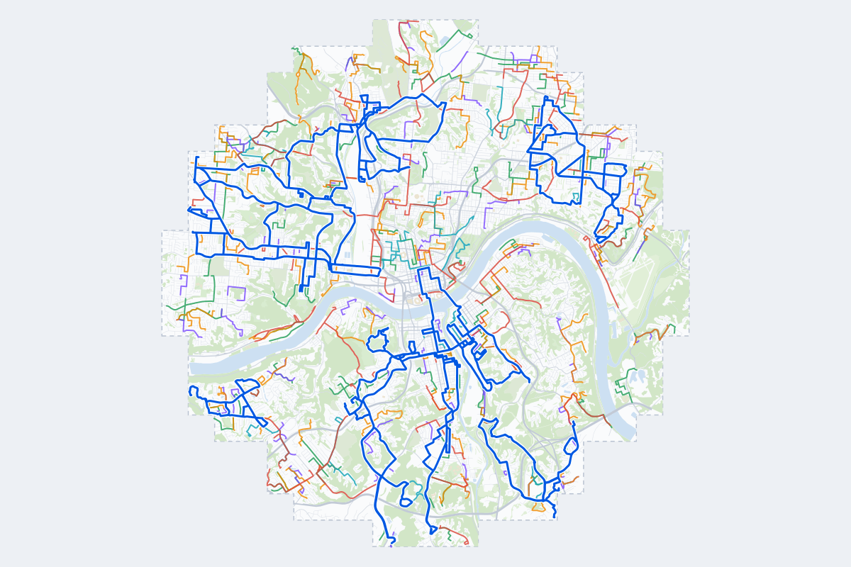
- 345Practice routes
- 602 miLength of all routes
- 29Different roundabouts
- 1,101Named streets
Route types
| Type | Routes | Typical length | Typical time |
|---|---|---|---|
First driveQuiet streets and simple junctions — a few easy turns | 81 | 1.0 mi | 3 min |
ParkingA short drive that ends in a street with free kerbside bays | 81 | 0.8 mi | 3 min |
JunctionsGive way, STOP and unmarked junctions on the side streets, with turns across the oncoming traffic — who goes first when there are no lights | 79 | 1.3 mi | 4 min |
RoundaboutsOne or more roundabouts on the way | 24 | 2.1 mi | 7 min |
Rush hourBusy avenues through the centre: traffic lights, lanes, turns across traffic | 52 | 2.1 mi | 7 min |
Driving test practiceA drive like the practical test: from a test centre and back where one is known, over the roads and junctions the examiner covers. | 28 | 6.3 mi | 20 min |
Test practice loops
The test drive here lasts about 20 min.
| Loop | Length | Time | Roundabouts | Traffic lights | Turns | Main streets |
|---|---|---|---|---|---|---|
| 1 | 5.3 mi | 17 min | 0 | 15 | 17 | East 15th Street, Decoursey Avenue, Madison Avenue, Church Street |
| 2 | 5.4 mi | 17 min | 0 | 11 | 18 | Mad Anthony Street, Central Parkway, Knowlton Street, Spring Grove Avenue |
| 3 | 5.5 mi | 18 min | 0 | 2 | 11 | Prospect Point Drive, Amsterdam Road, Niewahner Drive, Western Reserve Road |
| 4 | 5.6 mi | 18 min | 0 | 17 | 18 | Delta Avenue, Stanley Avenue, Linwood Avenue, Paxton Avenue |
| 5 | 5.6 mi | 18 min | 0 | 10 | 19 | State Avenue, Grand Avenue, Westwood Avenue, Glenway Avenue |
| 6 | 5.7 mi | 18 min | 0 | 17 | 23 | West Pike Street, Amsterdam Road, Park Road, Glazier Road |
| 7 | 5.8 mi | 19 min | 0 | 14 | 14 | Highland Pike, Kyles Lane, Dixie Highway, Madison Pike |
| 8 | 5.8 mi | 19 min | 0 | 25 | 17 | Edmondson Road, Madison Road, Section Avenue, Duck Creek Road |
| 9 | 5.8 mi | 19 min | 0 | 0 | 13 | Amsterdam Road, Valley Trails Drive, Villa Drive, Madonna Manor Drive |
| 10 | 6.0 mi | 19 min | 2 | 45 | 22 | Scott Boulevard, East Martin Luther King Junior Boulevard, Race Street, John A. Roebling Suspension Bridge |
| 11 | 6.0 mi | 19 min | 0 | 19 | 19 | Edwards Road, Grandin Road, Montgomery Road, Williams Avenue |
| 12 | 6.2 mi | 20 min | 0 | 18 | 19 | Ludlow Avenue, Spring Grove Avenue, West Martin Luther King Junior Drive, Elmore Street |
| 13 | 6.2 mi | 20 min | 0 | 13 | 15 | Gest Street, Elberon Avenue, Warsaw Avenue, Grand Avenue |
| 14 | 6.3 mi | 20 min | 0 | 19 | 19 | Vine Street, Spring Grove Avenue, Ludlow Avenue, McAlpin Avenue |
| 15 | 6.3 mi | 20 min | 0 | 16 | 17 | Glenway Avenue, Sidney Road, Saint Lawrence Avenue, Coronado Avenue |
| 16 | 6.4 mi | 21 min | 0 | 16 | 17 | Alexandria Pike, Grandview Avenue, Fort Beech Road, Lowell Street |
| 17 | 6.4 mi | 21 min | 0 | 10 | 22 | Beekman Street, McHenry Avenue, Harrison Avenue, Faraday Road |
| 18 | 6.4 mi | 21 min | 4 | 12 | 25 | Alexandria Pike, University Drive, Louie B. Nunn Drive, Deepwoods Drive |
| 19 | 6.7 mi | 21 min | 0 | 18 | 15 | Taylor Mill Road, Winston Avenue, Old Taylor Mill Road, Howard Litzler Drive |
| 20 | 6.7 mi | 21 min | 0 | 26 | 14 | Observatory Avenue, Erie Avenue, Williams Avenue, Linwood Avenue |
| 21 | 6.7 mi | 22 min | 2 | 8 | 10 | Madison Pike, Highland Pike, Magellan Drive, Crosby Parkway |
| 22 | 6.8 mi | 22 min | 0 | 18 | 16 | Glenway Avenue, Saint Lawrence Avenue, Rapid Run Pike, Cleves Warsaw Pike |
| 23 | 6.9 mi | 22 min | 0 | 23 | 21 | Licking Pike, Grandview Avenue, East Martin Luther King Junior Boulevard, Scott Boulevard |
| 24 | 6.9 mi | 22 min | 5 | 4 | 16 | Johns Hill Road, University Drive, Three Mile Road, Bentwood Hills Drive |
| 25 | 6.9 mi | 22 min | 4 | 5 | 16 | Johns Hill Road, Sunrock Boulevard, Bentwood Hills Drive, University Drive |
| 26 | 7.0 mi | 23 min | 0 | 25 | 11 | Queen City Avenue, Harrison Avenue, Werk Road, Midway Avenue |
| 27 | 7.1 mi | 23 min | 0 | 13 | 31 | Montague Road, Lewis Street, West 12th Street, East 15th Street |
| 28 | 7.1 mi | 23 min | 0 | 25 | 9 | Glenway Avenue, Queen City Avenue, Sunset Avenue, Gilsey Avenue |
Streets on the routes
The streets the routes of Cincinnati use most.
- Dixie Highway
- Harrison Avenue
- Glenway Avenue
- Amsterdam Road
- Alexandria Pike
- Baltimore Avenue
- Kellogg Avenue
- Spring Grove Avenue
- Anderson Ferry Road
- Buttermilk Pike
- Colerain Avenue
- Decoursey Avenue
- Elm Street
- Highland Avenue
- Monmouth Street
- Montana Avenue
- River Road
- Vine Street
- Grand Avenue
- Johns Hill Road
- Madison Road
- Main Street
- Montgomery Road
- Park Avenue
Nearby
How it works
- Open Cincinnati in Roadarium.
- Pick a route on the city map, or plan your own.
- Drive it in 3D with traffic, signs and lights, then see what to work on.