United Kingdom
London Driving practice routes
Practise driving on the streets of London on a 3D map — free, in your browser, with nothing to install.
Open London in RoadariumThe simulator opens on the city map, where you choose any route.
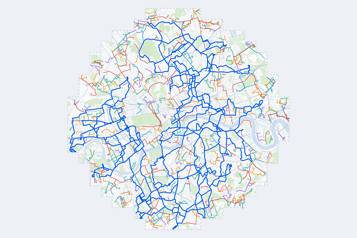
- 411Practice routes
- 813 miLength of all routes
- 122Different roundabouts
- 2,264Named streets
Route types
First drive
Quiet streets and simple junctions — a few easy turns
- Routes: 82
- Typical length: 0.9 mi
- Typical time: 3 min
Parking
A short drive that ends in a street with free kerbside bays
- Routes: 82
- Typical length: 0.8 mi
- Typical time: 3 min
Junctions
Give way, STOP and unmarked junctions on the side streets, with turns across the oncoming traffic — who goes first when there are no lights
- Routes: 81
- Typical length: 1.2 mi
- Typical time: 4 min
Roundabouts
One or more roundabouts on the way
- Routes: 67
- Typical length: 2.0 mi
- Typical time: 6 min
Rush hour
Busy avenues through the centre: traffic lights, lanes, turns across traffic
- Routes: 73
- Typical length: 2.0 mi
- Typical time: 6 min
Driving test practice
A drive like the practical test: from a test centre and back where one is known, over the roads and junctions the examiner covers.
- Routes: 26
- Typical length: 11 mi
- Typical time: 36 min
Test practice loops
The test drive here lasts 35–40 min.
| Loop | Length | Time | Roundabouts | Traffic lights | Turns | Main streets |
|---|---|---|---|---|---|---|
| 01 | 9.3 mi | 30 min | 3 | 36 | 38 | The Vale, Queen's Gate, Holland Park Avenue, Star Road |
| 02 | 9.8 mi | 32 min | 4 | 41 | 61 | Kensington High Street, Goldhawk Road, King Street, Burlington Lane |
| 03 | 10 mi | 32 min | 3 | 33 | 65 | Essex Road, Newington Green, Randolph Street, Petherton Road |
| 04 | 10 mi | 32 min | 2 | 40 | 55 | Essex Road, Dalston Lane, Amhurst Road, Graham Road |
| 05 | 10 mi | 33 min | 0 | 27 | 34 | Abbeville Road, Bedford Road, Burntwood Lane, Robsart Street |
| 06 | 10 mi | 33 min | 2 | 74 | 48 | Newington Green Road, Amwell Street, Horse Guards Road, Bloomsbury Street |
| 07 | 11 mi | 34 min | 1 | 33 | 42 | Plough Road, Bridgend Road, Lyford Road, Fulham Road |
| 08 | 11 mi | 34 min | 1 | 27 | 39 | Plough Road, Bridgend Road, New King's Road, Broadwater Road |
| 09 | 11 mi | 34 min | 1 | 38 | 50 | New King's Road, North End Road, Fulham Road, Lower Richmond Road |
| 10 | 11 mi | 35 min | 2 | 38 | 42 | Norwood Road, Peckham High Street, Hinton Road, Albany Road |
| 11 | 11 mi | 35 min | 1 | 37 | 73 | North End Road, Fulham Road, Lower Richmond Road, New King's Road |
| 12 | 11 mi | 36 min | 1 | 52 | 57 | Liverpool Road, St. John Street, London Wall, Barnsbury Road |
| 13 | 11 mi | 36 min | 1 | 32 | 49 | Coldharbour Lane, Acre Lane, Landor Road, Loughborough Road |
| 14 | 11 mi | 36 min | 1 | 22 | 56 | Hampstead Lane, Hornsey Lane, Stroud Green Road, Mansfield Road |
| 15 | 11 mi | 37 min | 3 | 37 | 55 | St Paul's Way, St James's Road, Cable Street, Trafalgar Avenue |
| 16 | 11 mi | 37 min | 6 | 35 | 59 | Burlington Lane, Acton Lane, Goldhawk Road, Du Cane Road |
| 17 | 12 mi | 37 min | 1 | 55 | 43 | Camberwell Green, Loughborough Road, Rosendale Road, Denmark Hill |
| 18 | 12 mi | 38 min | 5 | 100 | 81 | Rochester Row, Aldwych, Battersea Park Road, Queen Victoria Street |
| 19 | 12 mi | 38 min | 2 | 24 | 44 | East Dulwich Grove, Turney Road, Peckham Rye, Nunhead Lane |
| 20 | 12 mi | 38 min | 3 | 38 | 67 | St Helens Gardens, Goldhawk Road, Kilburn Lane, Dalling Road |
| 21 | 12 mi | 38 min | 5 | 29 | 47 | Crouch Hill, Highgate Road, Highgate West Hill, North Road |
| 22 | 12 mi | 38 min | 1 | 41 | 54 | King's Avenue, Garrad's Road, Streatham High Road, Valley Road |
| 23 | 12 mi | 38 min | 0 | 31 | 35 | Abbeville Road, Burntwood Lane, Norwood Road, Denmark Hill |
| 24 | 12 mi | 38 min | 1 | 45 | 65 | Branch Road, Trundley's Road, Druid Street, Stepney Way |
| 25 | 12 mi | 39 min | 3 | 88 | 72 | Borough High Street, Jamaica Road, Abbey Street, Rochester Row |
| 26 | 12 mi | 39 min | 0 | 41 | 53 | Tollington Park, Manor Parade, Kentish Town Road, Fairholt Road |
Streets on the routes
The streets the routes of London use most.
- Upper Richmond Road
- High Street
- Holland Park Avenue
- Lordship Lane
- Chiswick High Road
- Commercial Road
- Green Lanes
- High Road
- Hornsey Road
- Park Road
- Streatham High Road
- The Vale
- Uxbridge Road
- Grosvenor Avenue
- Highgate Road
- Holloway Road
- King Street
- Ladbroke Grove
- Lea Bridge Road
- Liverpool Road
- Newington Green Road
- Old Kent Road
- Seven Sisters Road
- St. Paul's Road
Test centres in London
- Ashford (Middlesex) test centre
- Barnet test centre
- Belvedere test centre
- Borehamwood test centre
- Brentwood test centre
- Bromley test centre
- Chertsey test centre
- Chingford test centre
- Enfield test centre
- Erith test centre
- Goodmayes test centre
- Greenford test centre
- Hendon test centre
- Hornchurch test centre
- Isleworth test centre
- Loughton test centre
- Mill Hill test centre
- Mitcham test centre
- Morden test centre
- Pinner test centre
- Sidcup test centre
- Slough test centre
- South Croydon test centre
- Southall test centre
- Tolworth test centre
- Tottenham test centre
- Uxbridge test centre
- Wanstead test centre
- West Wickham test centre
- Wood Green test centre
- Yeading test centre
Nearby
How it works
Open London in Roadarium.
Pick a route on the city map, or plan your own.
Drive it in 3D with traffic, signs and lights, then see what to work on.