United Kingdom
Birmingham Driving practice routes
Practise driving on the streets of Birmingham on a 3D map — free, in your browser, with nothing to install.
Open Birmingham in RoadariumThe simulator opens on the city map, where you choose any route.
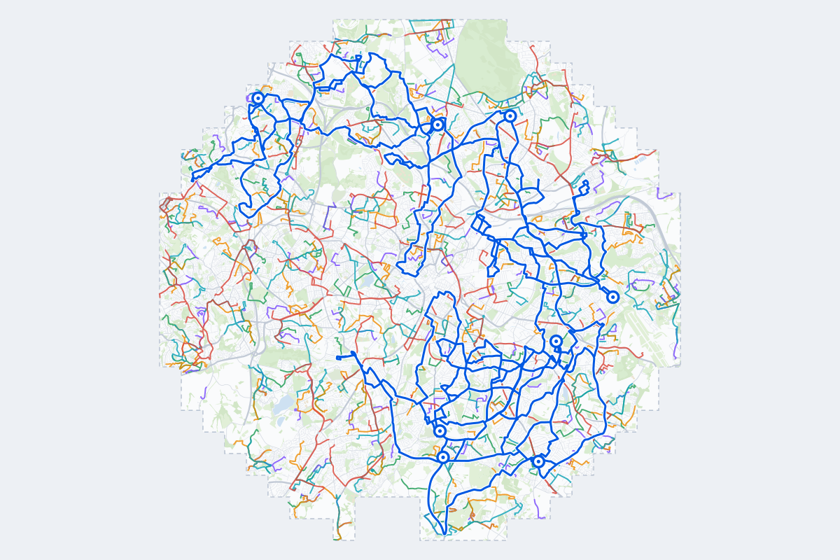
- 586Practice routes
- 1,086 miLength of all routes
- 483Different roundabouts
- 2,108Named streets
Route types
First drive
Quiet streets and simple junctions — a few easy turns
- Routes: 117
- Typical length: 1.0 mi
- Typical time: 3 min
Parking
A short drive that ends in a street with free kerbside bays
- Routes: 124
- Typical length: 0.8 mi
- Typical time: 3 min
Junctions
Give way, STOP and unmarked junctions on the side streets, with turns across the oncoming traffic — who goes first when there are no lights
- Routes: 120
- Typical length: 1.5 mi
- Typical time: 5 min
Roundabouts
One or more roundabouts on the way
- Routes: 117
- Typical length: 2.1 mi
- Typical time: 7 min
Rush hour
Busy avenues through the centre: traffic lights, lanes, turns across traffic
- Routes: 84
- Typical length: 2.2 mi
- Typical time: 7 min
Driving test practice
A drive like the practical test: from a test centre and back where one is known, over the roads and junctions the examiner covers.
- Routes: 24
- Typical length: 11 mi
- Typical time: 35 min
Test practice loops
The test drive here lasts 35–40 min. Each loop starts and finishes at the test centre.
| Loop | Test centre | Length | Time | Roundabouts | Traffic lights | Turns | Main streets |
|---|---|---|---|---|---|---|---|
| 01 | Birmingham (Cocks Moors Woods Leisure Centre) | 9.5 mi | 31 min | 10 | 2 | 43 | Fox Hollies Road, Chinn Brook Road, Wheelers Lane, Shaftmoor Lane |
| 02 | Birmingham (Cocks Moors Woods Leisure Centre) | 11 mi | 35 min | 6 | 13 | 33 | Church Road, Billesley Lane, Clevedon Road, Russell Road |
| 03 | Birmingham (Cocks Moors Woods Leisure Centre) | 11 mi | 35 min | 12 | 4 | 35 | School Road, Dolphin Lane, Redstone Farm Road, Wheelers Lane |
| 04 | Birmingham (Garretts Green) | 10 mi | 33 min | 18 | 10 | 42 | Newport Road, Tangmere Drive, Bradford Road, Cole Hall Lane |
| 05 | Birmingham (Garretts Green) | 11 mi | 37 min | 12 | 13 | 47 | Bordesley Green East, Washwood Heath Road, Aston Church Road, Lea Hall Road |
| 06 | Birmingham (Garretts Green) | 12 mi | 37 min | 14 | 19 | 49 | Bromford Lane, Bromford Road, Stechford Lane, Holly Lane |
| 07 | Birmingham (Kings Heath) | 9.3 mi | 30 min | 14 | 1 | 29 | Fox Hollies Road, Colebrook Road, School Road, Highfield Road |
| 08 | Birmingham (Kings Heath) | 9.9 mi | 32 min | 11 | 4 | 34 | Alcester Road South, School Road, Yardley Wood Road, Sarehole Road |
| 09 | Birmingham (Kings Heath) | 12 mi | 39 min | 7 | 11 | 46 | Druids Lane, Harborne Lane, Umberslade Road, Alcester Road South |
| 10 | Birmingham (Kingstanding) | 11 mi | 37 min | 4 | 6 | 50 | Birmingham Road, Beacon Road, Booths Lane, Skip Lane |
| 11 | Birmingham (Kingstanding) | 12 mi | 39 min | 6 | 23 | 44 | Aldridge Road, Witton Road, The Ridgeway, Constitution Hill |
| 12 | Birmingham (Kingstanding) | 12 mi | 39 min | 6 | 11 | 46 | Walsall Road, Aldridge Road, Hamstead Road, Chapel Lane |
| 13 | Birmingham (Shirley) | 9.6 mi | 31 min | 6 | 1 | 16 | Hollywood By-Pass, Colebrook Road, Shawhurst Lane, Bills Lane |
| 14 | Birmingham (Shirley) | 11 mi | 34 min | 10 | 18 | 24 | Lode Lane, Marshall Lake Road, Olton Road, Lyndon Road |
| 15 | Birmingham (Shirley) | 12 mi | 38 min | 12 | 13 | 33 | Lode Lane, Blossomfield Road, Hobs Moat Road, Brays Road |
| 16 | Birmingham (South Yardley) | 9.9 mi | 32 min | 11 | 4 | 36 | Olton Boulevard East, Shaftmoor Lane, Dolphin Lane, Cole Bank Road |
| 17 | Birmingham (South Yardley) | 10 mi | 34 min | 4 | 6 | 42 | Olton Boulevard East, Shaftmoor Lane, Wake Green Road, Stoney Lane |
| 18 | Birmingham (South Yardley) | 12 mi | 38 min | 3 | 14 | 41 | Bromford Lane, Yardley Road, Drews Lane, Washwood Heath Road |
| 19 | Birmingham (Sutton Coldfield) | 9.7 mi | 31 min | 5 | 14 | 34 | College Road, Witton Lodge Road, Antrobus Road, Rocky Lane |
| 20 | Birmingham (Sutton Coldfield) | 12 mi | 38 min | 5 | 24 | 34 | Slade Road, Court Lane, Bromford Lane, Wright Road |
| 21 | Birmingham (Sutton Coldfield) | 12 mi | 40 min | 6 | 27 | 37 | Bromford Lane, Boldmere Road, Court Lane, Bromford Road |
| 22 | Wednesbury | 9.7 mi | 31 min | 8 | 8 | 55 | Horseley Heath, Bagnall Street, Hydes Road, Great Bridge Street |
| 23 | Wednesbury | 9.8 mi | 31 min | 6 | 11 | 35 | Walsall Road, Hydes Road, Friar Park Road, Park Hall Road |
| 24 | Wednesbury | 10 mi | 34 min | 8 | 10 | 35 | Bridge Street, Phoenix Street, Crankhall Lane, Bromford Lane |
Streets on the routes
The streets the routes of Birmingham use most.
- Birmingham Road
- Church Road
- Stratford Road
- Warwick Road
- Station Road
- Chester Road
- Coleshill Road
- Walsall Road
- Vicarage Road
- Alcester Road South
- Alexandra Road
- Bromford Lane
- College Road
- High Street
- Highfield Road
- Kingsbury Road
- Alcester Road
- School Road
- Brunswick Park Road
- Halesowen Road
- Lode Lane
- Victoria Road
- Aldridge Road
- Arden Road
How it works
Open Birmingham in Roadarium.
Pick a route on the city map, or plan your own.
Drive it in 3D with traffic, signs and lights, then see what to work on.