
Canada
Ottawa: driving practice routes
Practise driving on the streets of Ottawa on a 3D map — free, in your browser, with nothing to install.
Open Ottawa in RoadariumThe simulator opens on the city map, where you choose any route.
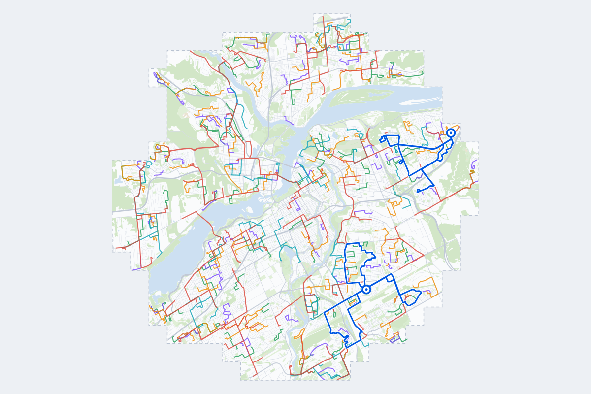
- 345Practice routes
- 819 kmLength of all routes
- 45Different roundabouts
- 1,106Named streets
Route types
| Type | Routes | Typical length | Typical time |
|---|---|---|---|
First driveQuiet streets and simple junctions — a few easy turns | 79 | 1.6 km | 3 min |
ParkingA short drive that ends in a street with free kerbside bays | 80 | 1.3 km | 3 min |
JunctionsGive way, STOP and unmarked junctions on the side streets, with turns across the oncoming traffic — who goes first when there are no lights | 77 | 1.9 km | 4 min |
RoundaboutsOne or more roundabouts on the way | 41 | 3.5 km | 7 min |
Rush hourBusy avenues through the centre: traffic lights, lanes, turns across traffic | 62 | 3.5 km | 7 min |
Driving test practiceA drive like the practical test: from a test centre and back where one is known, over the roads and junctions the examiner covers. | 6 | 10 km | 21 min |
Test practice loops
The test drive here lasts 20–30 min. Each loop starts and finishes at the test centre.
| Loop | Test centre | Length | Time | Roundabouts | Traffic lights | Turns | Main streets |
|---|---|---|---|---|---|---|---|
| 1 | Ottawa Canotek | 9.6 km | 19 min | 0 | 22 | 18 | Montréal Road, Ogilvie Road, Bathgate Drive, Shefford Road |
| 2 | Ottawa Canotek | 10 km | 21 min | 0 | 18 | 17 | Montréal Road, Mikinak Road, Avro Circle, Codd's Road |
| 3 | Ottawa Canotek | 11 km | 21 min | 0 | 20 | 26 | Ogilvie Road, Blair Road, Meadowbrook Road, Shefford Road |
| 4 | Ottawa Walkley | 9.0 km | 18 min | 0 | 10 | 21 | Briar Hill Drive, Smyth Road, Featherston Drive, Baycrest Drive |
| 5 | Ottawa Walkley | 9.1 km | 18 min | 0 | 16 | 15 | Walkley Road, Conroy Road, Blohm Drive, Johnston Road |
| 6 | Ottawa Walkley | 11 km | 23 min | 0 | 24 | 20 | Walkley Road, Bank Street, McCarthy Road, Hunt Club Road |
Streets on the routes
The streets the routes of Ottawa use most.
- Bank Street
- Montréal Road
- Walkley Road
- Hunt Club Road
- Riverside Drive
- St-Laurent Boulevard
- Boulevard La Vérendrye Ouest
- Boulevard Saint-Joseph
- Carling Avenue
- Boulevard du Plateau
- Chemin Vanier
- Blair Road
- Boulevard de la Cité-des-Jeunes
- Iris Street
- Rue Main
- Scott Street
- Byron Avenue
- Kilborn Avenue
- Ogilvie Road
- Rue Lafrance
- Shefford Road
- Uplands Drive
- Boulevard Alexandre-Taché
- Boulevard des Grives
Nearby
How it works
- Open Ottawa in Roadarium.
- Pick a route on the city map, or plan your own.
- Drive it in 3D with traffic, signs and lights, then see what to work on.